
Ostuni
→Cisternino
Roads: SP17
≈ 14 kmLine fixed
Route pack v1 · Confirmed loop
A 92 km paved motorcycle loop linking Ostuni, Cisternino, Locorotondo, Martina Franca, Alberobello and Ceglie Messapica before returning to Ostuni.
Public beta
Navigation beta available. Final commercial v1.0 will follow the complete field-recorded road test.
KM
≈ 92 km
Riding time
≈ 2 h 20 min moving
Difficulty
Easy–moderate
Road type
Paved secondary roads
Best season
Mar–Jun · Sep–Nov
Bike type
Any road bike · ideal for touring / adventure
Route story
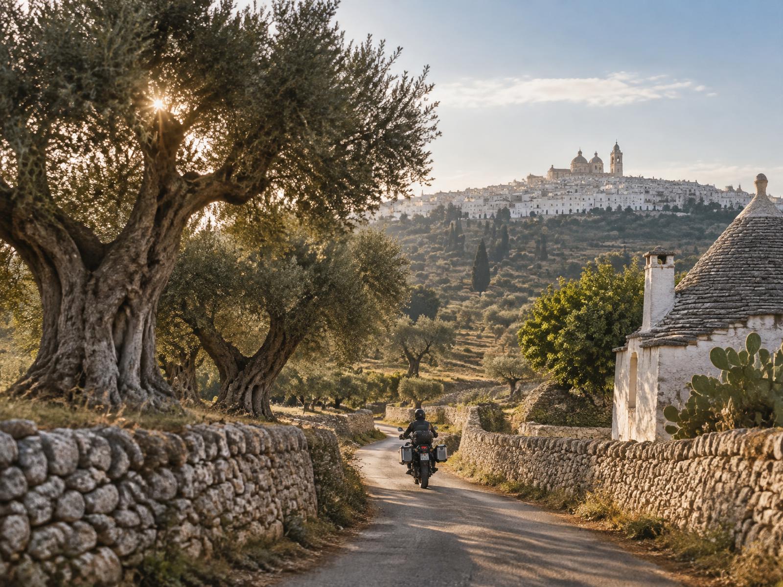
Ride between dry-stone walls, centuries-old olive trees, trulli, masserie and some of the region’s best-known hill towns.
The v1 loop starts and finishes in Ostuni, crossing the heart of the Valle d’Itria through Cisternino, Locorotondo, Martina Franca, Alberobello and Ceglie Messapica. The route pack combines the road line with practical access notes, stop strategy and local riding context.
Navigation format
The downloadable GPX is a navigation route (RTE), not a recorded wheel-by-wheel track (TRK). Navigation apps may recalculate between anchors: keep the named roads in the roadbook as the reference line.
Practical access notes checked 22 September 2026
Road line v1
The primary loop is locked at road level. Use these road names as the reference when a navigation app tries to recalculate a faster line.
Roads: SP17
Roads: SP11 · SP134
Roads: SS172
Roads: Via Carmine · Strada Spartacavalluzzo · SP58 · Strada Monte Tre Carlini · Via: Strada Monte Tre Carlini
Roads: SS172 · SP581 · Via: Locorotondo · Martina Franca
Roads: SP22
Suggested rhythm
The loop is designed to leave time for the places, not just the kilometres. Stop durations remain flexible.
Practical stops
Historic centres are treated as walking stops. Follow current signs and use signed parking on the outer approaches.
Start — leave the White City and turn inland toward the Valle d’Itria countryside.
Parking
Start outside the historic-centre ZTL. Use signed public parking on the outer approaches rather than navigating into Rione Terra.
ZTL
Ostuni operates a historic-centre ZTL. Treat every electronic gate and live sign as authoritative.
Food
Good place for breakfast before departure or a final aperitivo when the loop closes.
See
The old-town escarpment gives the classic view over the olive plain toward the Adriatic.
Local tip
Start early in warm months: the first hour through the countryside is quieter and cooler.
First village stop — a natural pause before continuing deeper into the valley.
Parking
Useful municipal options include Via F. Clarizia and Via Valle d’Itria / Miravalle.
ZTL
The historic centre is controlled by ZTL gates around Piazza Garibaldi and the Via Dante / Corso Umberto access system.
Food
If this is your lunch stop, Cisternino is the classic place to look for a fornello pronto and local grilled meat.
See
Walk a few minutes into the old town for views across the Valle d’Itria.
Local tip
Keep the motorcycle outside the old-town lanes: they are better explored on foot.
Continue through trulli country to one of the valley’s signature white hill towns.
Parking
Use signed parking outside the old town; Piazza Aldo Moro underground parking and the Via Martina Franca approach are practical references.
ZTL
The historic centre has seasonal traffic restrictions and electronic access controls. Do not follow sat-nav shortcuts through the white lanes.
Food
Keep this stop light if you plan lunch later: coffee, pastry or a quick local snack works well.
See
The public belvedere above the valley is one of the strongest panorama stops on the route.
Local tip
Give yourself 20–30 minutes on foot; the riding payoff is the approach and departure through the countryside.
The route reaches Martina Franca before taking the scenic trulli-country line toward Alberobello.
Parking
Piazza Mario Pagano / San Francesco and Orti del Duca are useful parking references outside the core historic streets.
ZTL
The centre uses ZTL controls. Park outside the old core and walk in.
Food
Martina Franca is a strong lunch alternative; capocollo di Martina Franca is the obvious local speciality.
See
The reward here is urban rather than panoramic: Baroque streets and the transition back into trulli countryside.
Local tip
Do not rush the exit toward Alberobello: this is the most rural-looking part of the loop.
Pass through the best-known trulli town before beginning the return side of the loop.
Parking
Municipal paid parking is available in several zones; useful references include Via Indipendenza, Piazzale Biagio Miraglia and Viale Morea.
ZTL
Avoid aiming navigation directly into the UNESCO trulli districts. Park first, then visit on foot.
Food
Expect the busiest stop of the day. For a quieter meal, eat earlier in Martina Franca or later in Ceglie.
See
Belvedere Santa Lucia is a classic on-foot overview of the trulli district after parking.
Local tip
In high season keep the stop intentional: 35–60 minutes is enough if the focus of the day is riding.
Final intermediate stop — approach on the panoramic SP581 before the closing run to Ostuni.
Parking
Park outside the historic core before the ZTL gates and use the signed public parking available around the centre.
ZTL
Via Porta di Giuso / Piazza Vecchia is controlled 24/7; Via Balilla has seasonal/time-based restrictions. Always check the live gate display.
Food
Ceglie is an excellent final food stop; local bakery and traditional cuisine are more rewarding than a rushed tourist stop.
See
The castle and old-town edge make a compact final walk before the last leg.
Local tip
The SP581 approach is one of the best flowing sections of the route: leave space ahead and enjoy it rather than chasing time.
Fuel strategy
Fuel in Ostuni before departure. Martina Franca is the natural mid-loop backup. With a 92 km total distance, most motorcycles will not need an additional stop.
ZTL rule
ZTL rules can change by season, day, event and time. Electronic gate displays and current road signs always override this roadbook.
Season
Best balance: spring and early autumn. In July–August ride early, expect heat and heavier traffic around Alberobello. After rain, rural lanes can carry mud, leaves and agricultural debris; winter daylight is short.
Inside route pack v1
GPX file
Digital roadbook
Curated stops
Viewpoints
Parking & ZTL notes
Local rider tips
Fuel & practical stops
Seasonal notes
Optional variants
Ride like a local
Ride the loop clockwise as published: it creates a natural progression from Ostuni into the valley and keeps Ceglie for the final food stop.
Do not judge the route only by the famous towns. The dry-stone walls, trulli roads and transitions between villages are the point.
Keep navigation audio on but the screen secondary: use the named roads in the roadbook when an app tries to shortcut.
In summer, aim to be moving before 09:00 and avoid making Alberobello your longest stop.
A road bike is enough. Adventure suspension is useful on imperfect rural surfaces, but there is no planned off-road section in v1.
Optional variants
Variant 01
Short loop · about 60–65 km: Ostuni → Cisternino → Locorotondo → Martina Franca → Ceglie Messapica → Ostuni. Skip Alberobello when time is limited or the town is exceptionally busy.
Variant 02
Eastern exploration · not included in the primary GPX: Alberobello → Coreggia → Canale di Pirro → Selva di Fasano → return south. Treat this as a separate field-test option, not the default line.
Route Pack v1
GPX navigation route + printable digital roadbook. Save both before departure and use the road names as the reference line.